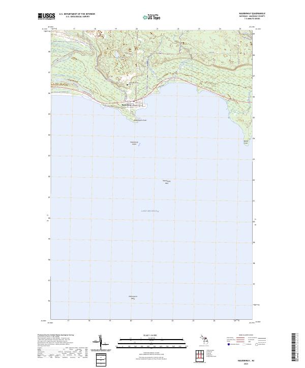
2023 Map of Naubinway
USGS Topo · Published 2023About this map
Naubinway serves as a northern anchor on this portion of the Upper Peninsula shoreline, where the Lower Millecoquins River meets the cold waters of Lake Michigan. The settlement's layout is closely tied to the waterfront, with streets like Main St and Lake St leading toward the protected harbor and Marina Dr. Just inland, the terrain is defined by a network of drainage including West Mile Creek and East Mile Creek, which cut through the wetlands of Garfield Township.
Find a feature on this map
34 named features on this map. Tap any name to fly to it.
Don’t see what you’re looking for? This feature index may not catch every label — zoom into the map to look around manually.
Map Details
Editions of this 2023 Naubinway Map
This is the sole edition of this map. No revisions or reprints were ever made.
Other maps of this area

1931 · Gould City NE
USGS Topo · 1:31,680

1931 · Gould City SE
USGS Topo · 1:31,680

1931 · Gilchrist NE
USGS Topo · 1:31,680

1931 · Gilchrist NW
USGS Topo · 1:31,680

1954 · Sault Sainte Marie
USGS Topo · 1:250,000

1955 · Hog Island
USGS Topo · 1:62,500

1955 · Cheboygan
USGS Topo · 1:250,000

1956 · Sault Sainte Marie
USGS Topo · 1:250,000

1957 · Sault Sainte Marie
USGS Topo · 1:250,000

1958 · Cheboygan
USGS Topo · 1:250,000