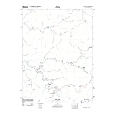
2010 Map of Naugatuck
USGS Topo · Published 2010About this map
The winding Tug Fork river defines the border and topography of this Mingo County landscape, where the settlements of Naugatuck and Maher follow the narrow valley floors. Transportation routes are tightly constrained by the terrain, with modern roads often paralleling historical paths like the Old N and W Railroad Bed Rd near Ajax. Family-named landmarks and small burial grounds, such as the Hanna Cemeteries and Waldron Cemetery, are scattered across the ridges and hollows, including Gun Rack Hollow and Turkey Hollow.
Find a feature on this map
102 named features on this map. Tap any name to fly to it.
Don’t see what you’re looking for? This feature index may not catch every label — zoom into the map to look around manually.
Map Details
Editions of this 2010 Naugatuck Map
This is the sole edition of this map. No revisions or reprints were ever made.
Other maps of this area

1887 · Warfield
USGS Topo · 1:125,000

1891 · Warfield
USGS Topo · 1:125,000

1909 · Matewan
USGS Topo · 1:48,000

1910 · Holden
USGS Topo · 1:48,000

1910 · Naugatuck
USGS Topo · 1:48,000

1912 · Naugatuck
USGS Topo · 1:62,500

1912 · Holden
USGS Topo · 1:62,500

1915 · Williamson
USGS Topo · 1:48,000

1915 · Naugatuck
USGS Topo · 1:48,000

1915 · Matewan
USGS Topo · 1:48,000