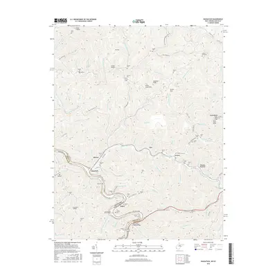
2016 Map of Naugatuck
USGS Topo · Published 2016About this map
The Tug Fork river defines the border between Kentucky and West Virginia, carving through the steep topography of Mingo County. This area is characterized by high ridges like Newsome Ridge and Kirk Ridge, with settlements concentrated in the narrow river valleys and along the N and W RR tracks. The community of Naugatuck sits near the confluence of Pigeon Creek, a major tributary that leads toward Ajax and Lenore. Transportation remains tied to the water, evidenced by the Canterbury Bridge and the William Shady Chapman Bridge. Numerous family burial grounds, including the Hanna Cemeteries and Wills Cem, are tucked into the hollows such as Turkey Hollow and Block Hollow, providing a detailed record of the region's multigenerational families. Traces of industrial history appear in labels like Copper Mine Br, suggesting a landscape shaped by both resource extraction and river commerce.
Find a feature on this map
120 named features on this map. Tap any name to fly to it.
Don’t see what you’re looking for? This feature index may not catch every label — zoom into the map to look around manually.
Map Details
Editions of this 2016 Naugatuck Map
This is the sole edition of this map. No revisions or reprints were ever made.
Other maps of this area

1887 · Warfield
USGS Topo · 1:125,000

1891 · Warfield
USGS Topo · 1:125,000

1909 · Matewan
USGS Topo · 1:48,000

1910 · Holden
USGS Topo · 1:48,000

1910 · Naugatuck
USGS Topo · 1:48,000

1912 · Naugatuck
USGS Topo · 1:62,500

1912 · Holden
USGS Topo · 1:62,500

1915 · Williamson
USGS Topo · 1:48,000

1915 · Naugatuck
USGS Topo · 1:48,000

1915 · Matewan
USGS Topo · 1:48,000