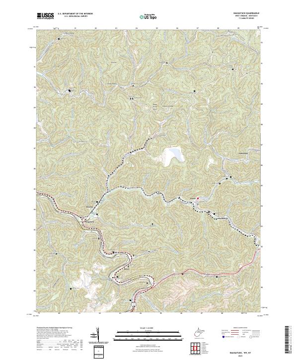
2023 Map of Naugatuck
USGS Topo · Published 2023About this map
Tug Fork carves a winding path along the border between West Virginia and Kentucky, anchoring a landscape where the valley floor serves as the primary corridor for settlements like Naugatuck and Maher. The topography is defined by narrow ridges and hollows, such as Sheep House Knob and Turkey Hollow, where family heritage is preserved in numerous upland burial sites including the Hanna Cemeteries and Brewer Cem. The influence of industry and transport is evident in the path of US Rte 52 and the legacy of rail infrastructure reflected in N and W Railroad Bed Rd. Toward the east, the communities of Lenore and Parsley Bottom sit near the confluence of several branches of Pigeon Creek, illustrating how the region's geography dictated the placement of schools and homes along the rare flat reaches of the creek banks.
Find a feature on this map
109 named features on this map. Tap any name to fly to it.
Don’t see what you’re looking for? This feature index may not catch every label — zoom into the map to look around manually.
Map Details
Editions of this 2023 Naugatuck Map
This is the sole edition of this map. No revisions or reprints were ever made.
Other maps of this area

1887 · Warfield
USGS Topo · 1:125,000

1891 · Warfield
USGS Topo · 1:125,000

1909 · Matewan
USGS Topo · 1:48,000

1910 · Holden
USGS Topo · 1:48,000

1910 · Naugatuck
USGS Topo · 1:48,000

1912 · Naugatuck
USGS Topo · 1:62,500

1912 · Holden
USGS Topo · 1:62,500

1915 · Williamson
USGS Topo · 1:48,000

1915 · Naugatuck
USGS Topo · 1:48,000

1915 · Matewan
USGS Topo · 1:48,000