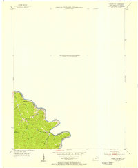
1954 Map of Naugatuck
USGS Topo · Published 1955About this map
The Tug Fork carves a sharp, winding boundary between Kentucky and West Virginia in this mid-century topographic study, defining the limits of Martin and Mingo Counties. The settlement at Winco Block is a focal point of activity along the river, supported by its own Winco Block Sch and a nearby Gas Well that indicates the local industrial footprint. The landscape is deeply dissected by steep hollows and branches, with ridges like Mt Sterling rising above the narrow valley floors.
Find a feature on this map
24 named features on this map. Tap any name to fly to it.
Don’t see what you’re looking for? This feature index may not catch every label — zoom into the map to look around manually.
Map Details
Editions of this 1954 Naugatuck Map
This is the sole edition of this map. No revisions or reprints were ever made.
Other maps of this area

1887 · Warfield
USGS Topo · 1:125,000

1891 · Warfield
USGS Topo · 1:125,000

1909 · Matewan
USGS Topo · 1:48,000

1910 · Holden
USGS Topo · 1:48,000

1910 · Naugatuck
USGS Topo · 1:48,000

1912 · Naugatuck
USGS Topo · 1:62,500

1912 · Holden
USGS Topo · 1:62,500

1915 · Williamson
USGS Topo · 1:48,000

1915 · Naugatuck
USGS Topo · 1:48,000

1915 · Matewan
USGS Topo · 1:48,000