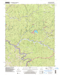
1997 Map of Naugatuck
USGS Topo · Published 2003About this map
The Tug River carves a deep, winding boundary between West Virginia and Kentucky in this late 1990s survey, anchoring the community of Naugatuck. The landscape is dominated by the narrow valley floors of Pigeon Creek and Marrowbone Creek, where settlements like Blocton, Maher, and Newsome are concentrated. A significant industrial presence is noted via the Norfolk and Western rail line and numerous gas wells scattered across the ridges, including Newsome Ridge and Sheep House Knob. Genealogists will find a dense concentration of family burial sites such as Vernmatter Cem, Waldron Cem, and the Mountain View Memorial Gardens. To the east, the Laurel Creek State Wildlife Mgmt Area preserves a large tract of territory, while local institutions like the Head of Long Branch Sch and Lenore Ch reflect the community structure of the Mingo County coalfields at the end of the century.
Find a feature on this map
96 named features on this map. Tap any name to fly to it.
Don’t see what you’re looking for? This feature index may not catch every label — zoom into the map to look around manually.
Map Details
Editions of this 1997 Naugatuck Map
This is the sole edition of this map. No revisions or reprints were ever made.
Other maps of this area

1887 · Warfield
USGS Topo · 1:125,000

1891 · Warfield
USGS Topo · 1:125,000

1909 · Matewan
USGS Topo · 1:48,000

1910 · Holden
USGS Topo · 1:48,000

1910 · Naugatuck
USGS Topo · 1:48,000

1912 · Naugatuck
USGS Topo · 1:62,500

1912 · Holden
USGS Topo · 1:62,500

1915 · Williamson
USGS Topo · 1:48,000

1915 · Naugatuck
USGS Topo · 1:48,000

1915 · Matewan
USGS Topo · 1:48,000