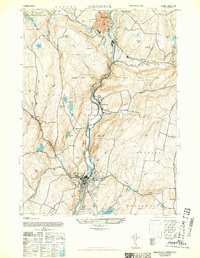
1943 Map of Naugatuck
USGS Topo · Published 1947About this map
The Naugatuck River serves as the industrial and geographical backbone of this mid-century landscape, carving a steep valley through New Haven County. Along its banks, the settlements of Naugatuck, Beacon Falls, and Seymour show the concentrated development typical of Connecticut's river-driven manufacturing era, with rail lines hugging the water's edge. This 1943 survey captures the complex water management system essential for local industry and residents, featuring numerous named catchments such as the Seymour Reservoirs, Candee Reservoir, and the Naugatuck Ice Co Pond.
Find a feature on this map
39 named features on this map. Tap any name to fly to it.
Don’t see what you’re looking for? This feature index may not catch every label — zoom into the map to look around manually.
Map Details
Editions of this 1943 Naugatuck Map
2 editions found

Other maps of this area

1889 · Derby
USGS Topo · 1:62,500

1891 · Derby
USGS Topo · 1:62,500

1892 · New Haven
USGS Topo · 1:62,500

1892 · Meriden
USGS Topo · 1:62,500

1893 · Waterbury
USGS Topo · 1:62,500

1893 · Meriden
USGS Topo · 1:62,500

1893 · Derby
USGS Topo · 1:62,500

1904 · Waterbury
USGS Topo · 1:62,500

1904 · Litchfield
USGS Topo · 1:125,000

1906 · Farmington
USGS Topo · 1:125,000