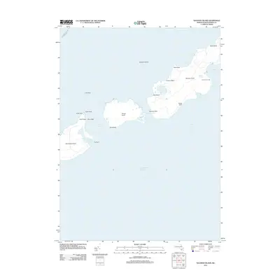
2012 Map of Naushon Island
USGS Topo · Published 2012About this map
Naushon Island and its neighbors in the Elizabeth Islands chain define this maritime landscape between Vineyard Sound and the open Atlantic Ocean. The survey highlights the maritime infrastructure of the early 21st century, including the New Bedford - Cuttyhunk Ferry Crossing and the safety-critical Tarpaulin Cove Light. The coastal morphology is intricately detailed, showing the protected waters of Tarpaulin Cove and the small freshwater bodies like Blaney Pond and French Watering Place. These features, alongside the narrow channels of Quicks Hole and Robinsons Hole, illustrate the treacherous yet essential waterways that connect the various islands. The terrain remains characterized by sandy reaches like Silver Beach and prominent coastal markers such as South Bluff and Naushon Point.
Find a feature on this map
28 named features on this map. Tap any name to fly to it.
Don’t see what you’re looking for? This feature index may not catch every label — zoom into the map to look around manually.
Map Details
Editions of this 2012 Naushon Island Map
This is the sole edition of this map. No revisions or reprints were ever made.
Other maps of this area

1885 · New Bedford
USGS Topo · 1:62,500

1886 · Falmouth
USGS Topo · 1:62,500

1887 · Gay Head
USGS Topo · 1:62,500

1888 · New Bedford
USGS Topo · 1:62,500

1888 · Falmouth
USGS Topo · 1:62,500

1889 · Gay Head
USGS Topo · 1:62,500

1893 · Gay Head
USGS Topo · 1:62,500

1893 · Falmouth
USGS Topo · 1:62,500

1893 · New Bedford
USGS Topo · 1:62,500

1915 · Falmouth
USGS Topo · 1:62,500