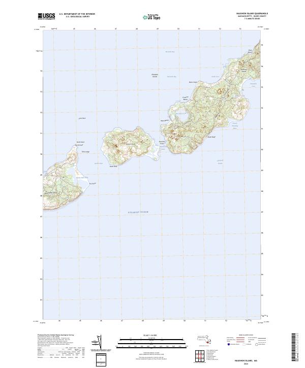
2024 Map of Naushon Island
USGS Topo · Published 2024About this map
Naushon Island and the surrounding Elizabeth Islands represent a preserved coastal landscape of the Massachusetts shore. This survey details the chain’s interior paths and isolated points of interest, from the historic Tarpaulin Cove to the narrow passages of Robinsons Hole and Quicks Hole. The mapping reveals a distinct topography of coastal ponds like Blaney Pond and Westend Pond, alongside family-named landmarks such as Rams Head and Felix Ledge.
Find a feature on this map
40 named features on this map. Tap any name to fly to it.
Don’t see what you’re looking for? This feature index may not catch every label — zoom into the map to look around manually.
Map Details
Editions of this 2024 Naushon Island Map
This is the sole edition of this map. No revisions or reprints were ever made.
Other maps of this area

1885 · New Bedford
USGS Topo · 1:62,500

1886 · Falmouth
USGS Topo · 1:62,500

1887 · Gay Head
USGS Topo · 1:62,500

1888 · New Bedford
USGS Topo · 1:62,500

1888 · Falmouth
USGS Topo · 1:62,500

1889 · Gay Head
USGS Topo · 1:62,500

1893 · Gay Head
USGS Topo · 1:62,500

1893 · Falmouth
USGS Topo · 1:62,500

1893 · New Bedford
USGS Topo · 1:62,500

1915 · Falmouth
USGS Topo · 1:62,500