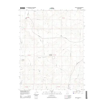
2014 Map of Navajo Canyon
USGS Topo · Published 2014About this map
Hovenweep National Monument anchors this high desert landscape, preserving archaeological history across a terrain defined by deep incisions like Navajo Canyon and Allen Canyon. The map reveals a remote corner of the Four Corners region where the rugged topography of Cajon Mesa meets the industrial footprint of the Aneth Oil Field. This intersection of federal preservation and energy extraction is connected by a network of specialized routes, including Cajon Mesa Rd and Old Aneth Rd. To the west, the drainage of Montezuma Cr marks the land, while family and historical waypoints are traced through labels such as Ismay Trading Post Rd and Spooner Rd. The map provides an intricate look at the canyon-and-mesa systems near the West Fork Allen Canyon, showing how modern infrastructure like Bia-5066 follows the natural contours of the ancient landscape.
Find a feature on this map
36 named features on this map. Tap any name to fly to it.
Don’t see what you’re looking for? This feature index may not catch every label — zoom into the map to look around manually.
Map Details
Editions of this 2014 Navajo Canyon Map
This is the sole edition of this map. No revisions or reprints were ever made.
Other maps of this area

1886 · Abajo
USGS Topo · 1:250,000

1892 · Abajo
USGS Topo · 1:250,000

1893 · Abajo
USGS Topo · 1:250,000

1956 · Cortez
USGS Topo · 1:250,000

1957 · Aneth 1 NE
USGS Topo · 1:24,000

1957 · Aneth 1 NW
USGS Topo · 1:24,000

1958 · Cortez
USGS Topo · 1:250,000

1958 · Aneth 1 SW
USGS Topo · 1:24,000
1958 · Aneth 1 SE
USGS Topo · 1:24,000

1958 · Cajon Mesa
USGS Topo · 1:62,500