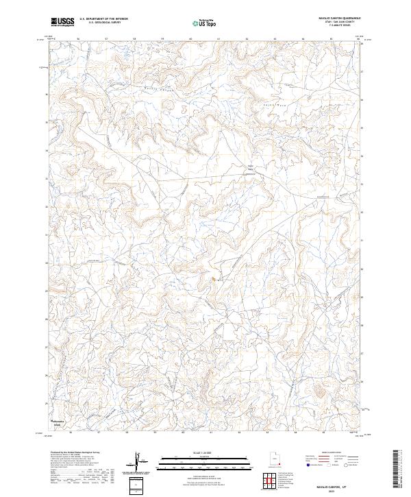
2023 Map of Navajo Canyon
USGS Topo · Published 2023About this map
Hovenweep National Monument preserves a high desert landscape marked by the complex geological and cultural history of Cajon Mesa. The terrain is deeply incised by the drainage systems of Navajo Canyon and the West Fork Allen Canyon, which eventually feed into Montezuma Creek near the settlement of the same name. This contemporary survey details a network of arterial roads, such as Old Aneth Rd and the Ismay Trading Post Rd, that cross the arid plateau to connect dispersed locations. The mapping reflects the intersection of tribal land management and federal preservation, shown through various designated routes like Reservation Rd and the Old Aneth Cutoff. It provides a clear view of how modern infrastructure navigates the challenging topography of the Allen Canyon area.
Find a feature on this map
24 named features on this map. Tap any name to fly to it.
Don’t see what you’re looking for? This feature index may not catch every label — zoom into the map to look around manually.
Map Details
Editions of this 2023 Navajo Canyon Map
This is the sole edition of this map. No revisions or reprints were ever made.
Other maps of this area

1886 · Abajo
USGS Topo · 1:250,000

1892 · Abajo
USGS Topo · 1:250,000

1893 · Abajo
USGS Topo · 1:250,000

1956 · Cortez
USGS Topo · 1:250,000

1957 · Aneth 1 NE
USGS Topo · 1:24,000

1957 · Aneth 1 NW
USGS Topo · 1:24,000

1958 · Cortez
USGS Topo · 1:250,000

1958 · Aneth 1 SW
USGS Topo · 1:24,000
1958 · Aneth 1 SE
USGS Topo · 1:24,000

1958 · Cajon Mesa
USGS Topo · 1:62,500