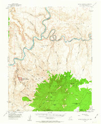
1953 Map of Navajo Mountain
USGS Topo · Published 1963About this map
Navajo Mountain dominates the southern landscape of this 1953 survey, rising as a landmark at the border of Utah and Arizona. Situated within the Navajo Indian Reservation, the area is defined by the deep incisions of Glen Canyon where the Colorado River meets the San Juan River. The terrain is remarkably intricate, characterized by a series of mesas such as Nasja Mesa and Wilson Mesa that are separated by labyrinthine drainages like Anasazi Canyon and Bald Rock Canyon.
Find a feature on this map
55 named features on this map. Tap any name to fly to it.
Don’t see what you’re looking for? This feature index may not catch every label — zoom into the map to look around manually.
Map Details
Editions of this 1953 Navajo Mountain Map
3 editions found

Other maps of this area

1883 · Marsh Pass
USGS Topo · 1:250,000

1886 · Escalante
USGS Topo · 1:250,000

1886 · Henry Mountains
USGS Topo · 1:250,000

1886 · Echo Cliffs
USGS Topo · 1:250,000

1891 · Echo Cliffs
USGS Topo · 1:250,000

1892 · Marsh Pass
USGS Topo · 1:250,000

1892 · Henry Mountains
USGS Topo · 1:250,000

1953 · Navajo Mountain 4 NW
USGS Topo · 1:24,000

1953 · Navajo Mountain 4 SW
USGS Topo · 1:24,000

1953 · Cummings Mesa
USGS Topo · 1:62,500