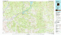
1980 Map of Navajo Reservoir
USGS Topo · Published 1981About this map
Navajo Reservoir dominates this high-altitude landscape where the San Juan River and Los Pinos River meet near the New Mexico and Colorado border. The map captures a moment when the regional infrastructure of the 1970s was firmly established, showing the network of state roads like 550 and 64 that connect the growing population centers of Aztec and Bloomfield. East of the reservoir, the vast expanse of the Carson National Forest is deeply etched by a complex system of drainage ways, including La Jara Canyon and Gubernador Canyon. The topography reveals the transition from the river valleys to the elevated plateaus of Manzanares Mesa and Blanco Mesa, illustrating how the arid geography dictated the placement of early settlements like Blanco and Turley along the life-giving watercourses of the San Juan Basin.
Find a feature on this map
35 named features on this map. Tap any name to fly to it.
Don’t see what you’re looking for? This feature index may not catch every label — zoom into the map to look around manually.
Map Details
Editions of this 1980 Navajo Reservoir Map
This is the sole edition of this map. No revisions or reprints were ever made.
Other maps of this area

1889 · Largo
USGS Topo · 1:250,000

1889 · Chaco
USGS Topo · 1:250,000

1892 · Chaco
USGS Topo · 1:250,000

1895 · Largo
USGS Topo · 1:250,000

1908 · Ignacio
USGS Topo · 1:125,000

1909 · Gallina
USGS Topo · 1:125,000

1913 · Red Mesa
USGS Topo · 1:62,500

1913 · Summitville
USGS Topo · 1:125,000

1915 · Summitville
USGS Topo · 1:125,000

1924 · Ignacio
USGS Topo · 1:125,000