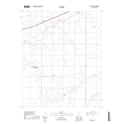
2018 Map of Navajo South
USGS Topo · Published 2018About this map
The Puerco River corridor dominates this high-desert landscape, serving as a historic conduit for both natural drainage and modern transportation through Apache County. Small settlements like Navajo and Pinta are positioned along the transit lines that follow the river's path, including the crossing at Crazy Creek Bridge. The map details a transition from the protected boundaries of Petrified Forest National Park in the west to the open cattle-country infrastructure of the east, evidenced by local landmarks such as Swamp Tank and Cottonwood Seep.
Find a feature on this map
24 named features on this map. Tap any name to fly to it.
Don’t see what you’re looking for? This feature index may not catch every label — zoom into the map to look around manually.
Map Details
Editions of this 2018 Navajo South Map
This is the sole edition of this map. No revisions or reprints were ever made.
Other maps of this area

1886 · St Johns
USGS Topo · 1:250,000

1886 · Fort Defiance
USGS Topo · 1:250,000

1892 · Fort Defiance
USGS Topo · 1:250,000

1892 · St Johns
USGS Topo · 1:250,000

1954 · Saint Johns
USGS Topo · 1:250,000

1954 · Gallup
USGS Topo · 1:250,000

1956 · Adamana 1 NW
USGS Topo · 1:24,000

1957 · Saint Johns
USGS Topo · 1:250,000

1958 · Gallup
USGS Topo · 1:250,000

1958 · Saint Johns
USGS Topo · 1:250,000