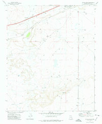
1972 Map of Navajo South
USGS Topo · Published 1975About this map
The settlement of Navajo and the corridor of the Atchison Topeka and Santa Fe railroad define this section of the Arizona high desert in the early 1970s. The landscape is marked by the wide path of the Puerco River and its seasonal tributaries like Crazy Creek and Horse Draw. Water management in this arid environment is evident through the numerous Gas Wells and strategically placed livestock watering points such as Swamp Tank, East Tank, and the natural Cottonwood Seep.
Find a feature on this map
19 named features on this map. Tap any name to fly to it.
Don’t see what you’re looking for? This feature index may not catch every label — zoom into the map to look around manually.
Map Details
Editions of this 1972 Navajo South Map
This is the sole edition of this map. No revisions or reprints were ever made.
Other maps of this area

1886 · St Johns
USGS Topo · 1:250,000

1886 · Fort Defiance
USGS Topo · 1:250,000

1892 · Fort Defiance
USGS Topo · 1:250,000

1892 · St Johns
USGS Topo · 1:250,000

1954 · Saint Johns
USGS Topo · 1:250,000

1954 · Gallup
USGS Topo · 1:250,000

1956 · Adamana 1 NW
USGS Topo · 1:24,000

1957 · Saint Johns
USGS Topo · 1:250,000

1958 · Gallup
USGS Topo · 1:250,000

1958 · Saint Johns
USGS Topo · 1:250,000