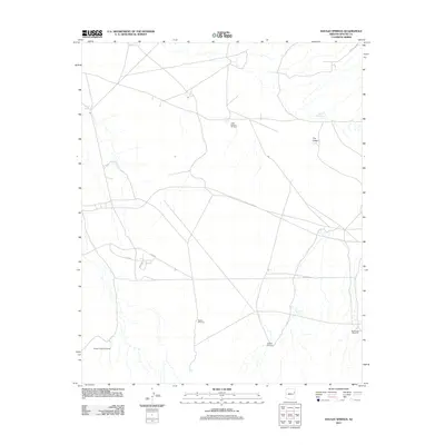
2011 Map of Navajo Springs
USGS Topo · Published 2011About this map
Navajo Springs anchors this high-desert landscape in Apache County, serving as a primary water source in a region defined by scattered tanks and named windmills. The geography reveals a ranching and water-management network essential for the arid terrain, where local landmarks like the Little Wallace Windmill and Teclote Windmill denote critical points of human intervention. Surface water is scarce, recorded only at sites like Salt Seeps, Water Dog Tank, and Jacobs Tank, which sustain the local livestock and wildlife.
Find a feature on this map
16 named features on this map. Tap any name to fly to it.
Don’t see what you’re looking for? This feature index may not catch every label — zoom into the map to look around manually.
Map Details
Editions of this 2011 Navajo Springs Map
This is the sole edition of this map. No revisions or reprints were ever made.
Other maps of this area

1886 · St Johns
USGS Topo · 1:250,000

1886 · Fort Defiance
USGS Topo · 1:250,000

1892 · Fort Defiance
USGS Topo · 1:250,000

1892 · St Johns
USGS Topo · 1:250,000

1954 · Saint Johns
USGS Topo · 1:250,000

1954 · Gallup
USGS Topo · 1:250,000

1957 · Saint Johns
USGS Topo · 1:250,000

1958 · Gallup
USGS Topo · 1:250,000

1958 · Saint Johns
USGS Topo · 1:250,000

1959 · Gallup
USGS Topo · 1:250,000