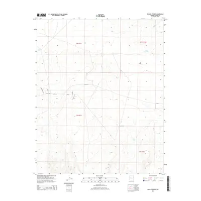
2014 Map of Navajo Springs
USGS Topo · Published 2014About this map
Navajo Springs serves as a vital water source in this arid high-desert landscape within the Fort Defiance Agency. The 2014 survey reveals a sparse but deliberate network of local roads such as Navajo Springs Blvd, Heritage Ln, and Rodeo Dr, suggesting modern residential or ranching development near established landmarks. The terrain is marked by distinctive hydrological features including Salt Seeps and several collection points like Water Dog Tank, Jacobs Tank, and Lost Tank. A notable geological landmark, The Crater, dominates the northeastern portion of the quadrangle. The presence of Wagon Wheel Dr and Rim Rd indicates the expansion of rural infrastructure across the township lines of T20N and T19N, while routes like Bia-2030 highlight the administrative role of the Bureau of Indian Affairs in maintaining regional connectivity.
Find a feature on this map
21 named features on this map. Tap any name to fly to it.
Don’t see what you’re looking for? This feature index may not catch every label — zoom into the map to look around manually.
Map Details
Editions of this 2014 Navajo Springs Map
This is the sole edition of this map. No revisions or reprints were ever made.
Other maps of this area

1886 · St Johns
USGS Topo · 1:250,000

1886 · Fort Defiance
USGS Topo · 1:250,000

1892 · Fort Defiance
USGS Topo · 1:250,000

1892 · St Johns
USGS Topo · 1:250,000

1954 · Saint Johns
USGS Topo · 1:250,000

1954 · Gallup
USGS Topo · 1:250,000

1957 · Saint Johns
USGS Topo · 1:250,000

1958 · Gallup
USGS Topo · 1:250,000

1958 · Saint Johns
USGS Topo · 1:250,000

1959 · Gallup
USGS Topo · 1:250,000