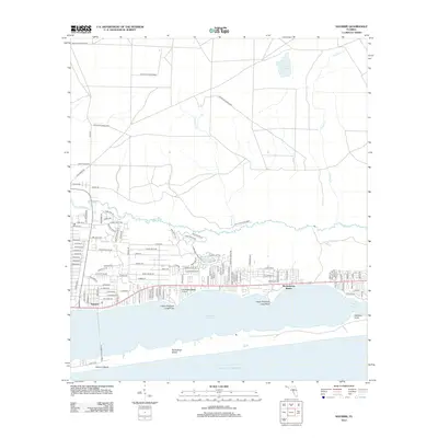
2012 Map of Navarre
USGS Topo · Published 2012About this map
Eglin Air Force Base dominates the northern expanse of this Florida coastal landscape, where the wooded interior meets the delicate drainage of Panther Cr and Prairie Cr. Along the shoreline of the Santa Rosa Sound, the residential growth of Navarre and Wynnehaven Beach is clearly visible, showing a dense network of suburban streets such as Sevilla St and Tampa Blvd. South of The Narrows, the map extends to the barrier sands of Santa Rosa Island and the established resort area at Navarre Beach. This survey provides a precise record of coastal infrastructure, including the Fort Walton Beach Airport and prominent natural landmarks like Lower Pritchard Long Point and Upper Pritchard Long Point, situated between the freshwater flow of the East Bay River and the open waters of the Gulf of Mexico.
Find a feature on this map
117 named features on this map. Tap any name to fly to it.
Don’t see what you’re looking for? This feature index may not catch every label — zoom into the map to look around manually.
Map Details
Editions of this 2012 Navarre Map
This is the sole edition of this map. No revisions or reprints were ever made.
Other maps of this area

1921 · Holley
USGS Topo · 1:62,500

1934 · Holt
USGS Topo · 1:48,000

1934 · Harold
USGS Topo · 1:62,500

1936 · Holley
USGS Topo · 1:48,000

1937 · Holt
USGS Topo · 1:62,500

1937 · Harold
USGS Topo · 1:62,500

1938 · Mary Esther
USGS Topo · 1:62,500

1938 · Holley
USGS Topo · 1:62,500

1938 · Harold
USGS Topo · 1:62,500

1956 · Fort Walton Beach
USGS Topo · 1:62,500