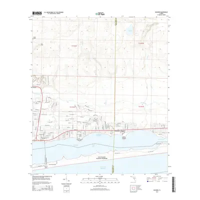
2015 Map of Navarre
USGS Topo · Published 2015About this map
Santa Rosa Island and the Gulf Islands National Seashore dominate the coastal profile of this 2015 survey, protecting the southern edge of the Santa Rosa Sound. The landscape is a study in transition, where the dense residential street grids of Navarre and Wynnehaven Beach meet the natural wetlands and tributaries north of the Intracoastal Waterway. The presence of the Fort Walton Beach Airport and the inland path of the Florida National Scenic Trail illustrate the area's dual role as a growing residential corridor and a recreational gateway. Further north, the terrain shifts into a more primitive hydrology marked by Prairie Ponds and the winding course of the East Bay River, revealing the low-lying coastal plains before they reach the interior highlands of East Head and Steep Head.
Find a feature on this map
119 named features on this map. Tap any name to fly to it.
Don’t see what you’re looking for? This feature index may not catch every label — zoom into the map to look around manually.
Map Details
Editions of this 2015 Navarre Map
This is the sole edition of this map. No revisions or reprints were ever made.
Other maps of this area

1921 · Holley
USGS Topo · 1:62,500

1934 · Holt
USGS Topo · 1:48,000

1934 · Harold
USGS Topo · 1:62,500

1936 · Holley
USGS Topo · 1:48,000

1937 · Holt
USGS Topo · 1:62,500

1937 · Harold
USGS Topo · 1:62,500

1938 · Mary Esther
USGS Topo · 1:62,500

1938 · Holley
USGS Topo · 1:62,500

1938 · Harold
USGS Topo · 1:62,500

1956 · Fort Walton Beach
USGS Topo · 1:62,500