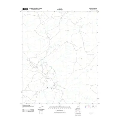
2011 Map of Nazlini
USGS Topo · Published 2011About this map
Nazlini serves as the central hub of this high-desert landscape, situated where the arid terrain transitions into the depths of Nazlini Canyon. The local infrastructure reflects the area's logistical importance and cultural history, anchored by the Nazlini Trading Post and the nearby Nazlini Airport. Transportation routes like Indian Rte-27 and the Gas Pipeline Rd cut through a landscape defined by significant hydrological features, including the winding Nazlini Creek and seasonal drainages such as Rock Top Wash. To the north and east, the terrain rises into prominent landforms like Gray Mountain, Rock Mesa, and the uniquely named Pillow Mountain. These features, combined with reliable water sources like Tsegito Spring, illustrate a traditional pattern of settlement and movement through the canyon country of the Chinle Agency.
Find a feature on this map
15 named features on this map. Tap any name to fly to it.
Don’t see what you’re looking for? This feature index may not catch every label — zoom into the map to look around manually.
Map Details
Editions of this 2011 Nazlini Map
This is the sole edition of this map. No revisions or reprints were ever made.
Other maps of this area

1886 · Fort Defiance
USGS Topo · 1:250,000

1892 · Fort Defiance
USGS Topo · 1:250,000

1892 · Canyon De Chelly
USGS Topo · 1:250,000

1954 · Shiprock
USGS Topo · 1:250,000

1954 · Gallup
USGS Topo · 1:250,000

1955 · Zith-Tusayan Butte 2 SE
USGS Topo · 1:24,000

1955 · Zith-Tusayan Butte 2 SW
USGS Topo · 1:24,000

1955 · Zith-Tusayan Butte 2 NW
USGS Topo · 1:24,000

1955 · Chinle 4 SE
USGS Topo · 1:24,000

1955 · Zith-Tusayan Butte 2 NE
USGS Topo · 1:24,000