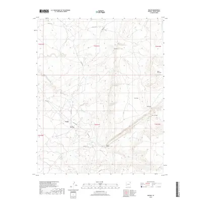
2018 Map of Nazlini
USGS Topo · Published 2018About this map
Nazlini serves as the primary hub in this high-desert landscape, situated where the Gas Pipeline Rd and Indian Rte 27 intersect. The terrain is defined by dramatic geological formations, most notably the deep incision of Nazlini Canyon and the prominent elevations of Gray Mtn and Rock Mesa. A complex network of ephemeral drainage systems, including Tah-aith-cheed Wash and Rock Top Wash, illustrates the seasonal water movement toward the main artery of Nazlini Creek. Isolated water sources such as Tsegito Spring highlight the critical locations for life in this arid environment. The map also records early 21st-century infrastructure, with routes like Indian Rte 8015 and Co Rd 310 connecting the scattered settlements and grazing lands across the Navajo Nation.
Find a feature on this map
24 named features on this map. Tap any name to fly to it.
Don’t see what you’re looking for? This feature index may not catch every label — zoom into the map to look around manually.
Map Details
Editions of this 2018 Nazlini Map
This is the sole edition of this map. No revisions or reprints were ever made.
Other maps of this area

1886 · Fort Defiance
USGS Topo · 1:250,000

1892 · Fort Defiance
USGS Topo · 1:250,000

1892 · Canyon De Chelly
USGS Topo · 1:250,000

1954 · Shiprock
USGS Topo · 1:250,000

1954 · Gallup
USGS Topo · 1:250,000

1955 · Zith-Tusayan Butte 2 SE
USGS Topo · 1:24,000

1955 · Zith-Tusayan Butte 2 SW
USGS Topo · 1:24,000

1955 · Zith-Tusayan Butte 2 NW
USGS Topo · 1:24,000

1955 · Chinle 4 SE
USGS Topo · 1:24,000

1955 · Zith-Tusayan Butte 2 NE
USGS Topo · 1:24,000