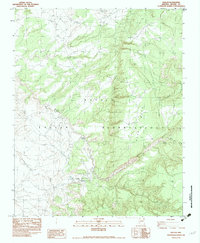
1983 Map of Nazlini
USGS Topo · Published 1983About this map
Nazlini serves as the central hub of this 1983 Navajo Nation interior, situated within the Navajo Indian Reservation. The community structure is defined by the presence of a Chapter House, a local Trading Post, and a Boarding Sch, reflecting the administrative and educational infrastructure of the era. To the north and east, the landscape is dominated by significant elevations such as Gray Mountain and Upper Forest Mountain, while the hydrology of the region is traced through the intricate drainage of Nazlini Creek and its many tributary washes, including Toh-ath-cheed Wash. Scattered across the high desert floor are practical landmarks of ranching and ancient history, from a network of Windmills and Corrals to isolated archaeological Ruins and a Cave tucked away near the canyon walls. This survey captures a moment of modern development, noted by a underground gas pipeline, set against the timeless geology of Rock Mesa.
Find a feature on this map
26 named features on this map. Tap any name to fly to it.
Don’t see what you’re looking for? This feature index may not catch every label — zoom into the map to look around manually.
Map Details
Editions of this 1983 Nazlini Map
This is the sole edition of this map. No revisions or reprints were ever made.
Other maps of this area

1886 · Fort Defiance
USGS Topo · 1:250,000

1892 · Fort Defiance
USGS Topo · 1:250,000

1892 · Canyon De Chelly
USGS Topo · 1:250,000

1954 · Shiprock
USGS Topo · 1:250,000

1954 · Gallup
USGS Topo · 1:250,000

1955 · Zith-Tusayan Butte 2 SE
USGS Topo · 1:24,000

1955 · Zith-Tusayan Butte 2 SW
USGS Topo · 1:24,000

1955 · Zith-Tusayan Butte 2 NW
USGS Topo · 1:24,000

1955 · Chinle 4 SE
USGS Topo · 1:24,000

1955 · Zith-Tusayan Butte 2 NE
USGS Topo · 1:24,000