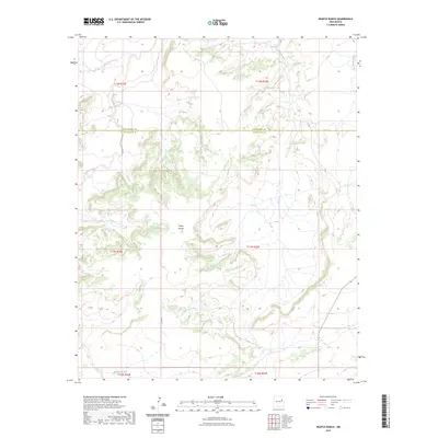
2023 Map of Neafus Ranch
USGS Topo · Published 2023About this map
Cañon Bonita sits at the heart of this landscape, where the high desert terrain transitions across the boundary of San Miguel and Guadalupe counties. The area is defined by a network of drainage systems, including the northern reach of Little Cuervo Creek and the eastern flow of La Manga Creek. This 2023 survey illustrates a sparsely populated ranching territory where physical geography dictates movement, as seen with the winding path of Co RD Fa navigating the southwestern elevations. To the south, the Difrises Arroyo marks the lower terrain, contrasting with the more complex topography found near the main Cuervo Creek. The map provides a precise look at the land's natural contours and watercourses in a remote section of east-central New Mexico.
Find a feature on this map
13 named features on this map. Tap any name to fly to it.
Don’t see what you’re looking for? This feature index may not catch every label — zoom into the map to look around manually.
Map Details
Editions of this 2023 Neafus Ranch Map
This is the sole edition of this map. No revisions or reprints were ever made.
Other maps of this area

1954 · Santa Fe
USGS Topo · 1:250,000

1958 · Santa Fe
USGS Topo · 1:250,000

1963 · Mesita Del Gato
USGS Topo · 1:24,000

1963 · Cuervo
USGS Topo · 1:24,000

1964 · Neafus Ranch
USGS Topo · 1:24,000

1964 · Gate Canyon
USGS Topo · 1:24,000

1964 · Newkirk
USGS Topo · 1:24,000

1964 · Ortega Tank
USGS Topo · 1:24,000

1967 · Tenaja Mesa
USGS Topo · 1:24,000

1972 · La Silla
USGS Topo · 1:24,000