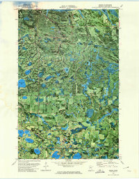
1972 Map of Nebish
USGS Topo · Published 1974About this map
Red Lake Indian Reservation lands dominate the northern half of this Beltrami County landscape, where the dense hydrology of the Minnesota north woods is meticulously documented via orthophotomapping. This specific 1970s survey combines aerial imagery with traditional topographic data to reveal the intricate wetland patterns of the Buena Vista State Forest. The settlement of Nebish serves as a central landmark amidst a complex network of glacial lakes, including Nebish Lake, Dark Lake, and Hagali Lake.
Find a feature on this map
17 named features on this map. Tap any name to fly to it.
Don’t see what you’re looking for? This feature index may not catch every label — zoom into the map to look around manually.
Map Details
Editions of this 1972 Nebish Map
This is the sole edition of this map. No revisions or reprints were ever made.
Other maps of this area

1919 · Quiring
USGS Topo · 1:62,500

1920 · Buena Vista
USGS Topo · 1:62,500

1954 · Bemidji
USGS Topo · 1:250,000

1957 · Bemidji
USGS Topo · 1:250,000

1958 · Bemidji
USGS Topo · 1:250,000

1972 · Redby
USGS Topo · 1:24,000

1972 · White Fish Lake
USGS Topo · 1:24,000
1972 · O'Brien Lookout Tower
USGS Topo · 1:24,000
1972 · Tenstrike
USGS Topo · 1:24,000
1972 · Redby NE
USGS Topo · 1:24,000