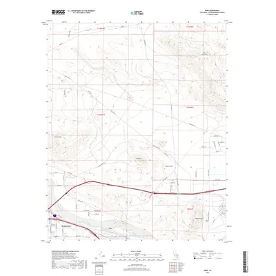
2018 Map of Nebo
USGS Topo · Published 2018About this map
Barstow serves as the focal point of this Mojave landscape, where the Mojave River course meets a complex network of desert transit. The map documents the eastern edges of the city and the adjacent settlement of Nebo, situated south of the sprawling Mojave Desert terrain. Transportation routes dominate the geography, from the historical alignment of Old Hwy 58 and Fossil Bed Rd to the modern corridors of Fort Irwin Rd and the Yermo Cutoff. To the north and east, the topography rises into the Calico Mountains and Mitchel Range, while prominent local landmarks like Elephant Mtn and Lead Mtn define the horizon. This survey illustrates the modern configuration of desert infrastructure and residential expansion in the high desert, tracing how development follows the river valley and existing rail and road arterials.
Find a feature on this map
59 named features on this map. Tap any name to fly to it.
Don’t see what you’re looking for? This feature index may not catch every label — zoom into the map to look around manually.
Map Details
Editions of this 2018 Nebo Map
This is the sole edition of this map. No revisions or reprints were ever made.
Other maps of this area

1915 · Searles Lake
USGS Topo · 1:250,000

1932 · Barstow
USGS Topo · 1:125,000

1933 · Avawatz Mountains
USGS Topo · 1:250,000

1934 · Barstow
USGS Topo · 1:125,000

1947 · Trona
USGS Topo · 1:250,000

1948 · Trona
USGS Topo · 1:250,000

1948 · Lane Mountain
USGS Topo · 1:62,500

1951 · Lane Mountain
USGS Topo · 1:62,500

1953 · San Bernardino
USGS Topo · 1:250,000

1953 · Yermo
USGS Topo · 1:24,000