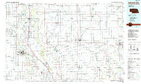
1985 Map of Nebraska City
USGS Topo · Published 1985About this map
Nebraska City serves as a central anchor in this mid-1980s survey, situated along the western banks of the Missouri River. The map illustrates the complex boundary dynamics of the region, including the shifting river channel near McKissick Island and Schimmel Island. This interstate landscape covers portions of Nebraska, Iowa, and Missouri, where the agricultural grid is interwoven with significant conservation areas like Arbor Lodge State Park and the Forneys Lake State Wildlife Management Area.
Find a feature on this map
126 named features on this map. Tap any name to fly to it.
Don’t see what you’re looking for? This feature index may not catch every label — zoom into the map to look around manually.
Map Details
Editions of this 1985 Nebraska City Map
This is the sole edition of this map. No revisions or reprints were ever made.
Other maps of this area

1893 · Fremont
USGS Topo · 1:125,000

1896 · Fremont
USGS Topo · 1:125,000

1903 · Weeping Water
USGS Topo · 1:125,000

1907 · Nebraska City
USGS Topo · 1:62,500

1915 · Nemaha
USGS Topo · 1:62,500

1915 · Howe
USGS Topo · 1:62,500

1929 · Weeping Water
USGS Topo · 1:125,000

1935 · Nehawka
USGS Topo · 1:48,000

1939 · Tarkio
USGS Topo · 1:62,500

1939 · Farragut
USGS Topo · 1:62,500