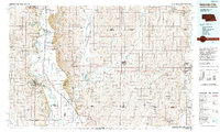
1993 Map of Nebraska City
USGS Topo · Published 1993About this map
The Missouri River forms the central spine of this region, separating the loess hills of Nebraska City and Plattsmouth from the productive agricultural plains of southwest Iowa. The landscape is a complex network of managed wetlands and wildlife areas, including Forneys Lake State Wildlife Management Area and Bartlett State Wildlife Management Area, which flank the river's winding course. These bottomlands are dotted with unique features like McKissick Island and Noodleman Island, illustrating the shifting geography of the state border.
Find a feature on this map
109 named features on this map. Tap any name to fly to it.
Don’t see what you’re looking for? This feature index may not catch every label — zoom into the map to look around manually.
Map Details
Editions of this 1993 Nebraska City Map
This is the sole edition of this map. No revisions or reprints were ever made.
Other maps of this area

1893 · Fremont
USGS Topo · 1:125,000

1896 · Fremont
USGS Topo · 1:125,000

1903 · Weeping Water
USGS Topo · 1:125,000

1907 · Nebraska City
USGS Topo · 1:62,500

1915 · Nemaha
USGS Topo · 1:62,500

1915 · Howe
USGS Topo · 1:62,500

1929 · Weeping Water
USGS Topo · 1:125,000

1935 · Nehawka
USGS Topo · 1:48,000

1939 · Tarkio
USGS Topo · 1:62,500

1939 · Farragut
USGS Topo · 1:62,500