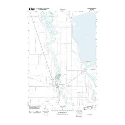
2010 Map of Necedah
USGS Topo · Published 2010About this map
Necedah sits at the heart of this landscape, positioned where the winding Yellow River approaches the massive expanse of Petenwell Lake. The terrain is defined by dramatic vertical features such as Necedah Bluff and Petenwell Rock, which stand in contrast to the flat, water-dominated lowlands to the east. The intricate, meandering path of the Yellow River north of town eventually gives way to a more structured water management system involving the Necedah Dam and the West Petenwell Ditch. Local infrastructure is well-established, with the Necedah Airport and Bay View Cemetery serving as key landmarks. To the east, the Petenwell 2WP722 Dam manages the flow of the Wisconsin River, marking the eastern boundary of this central Wisconsin study.
Find a feature on this map
48 named features on this map. Tap any name to fly to it.
Don’t see what you’re looking for? This feature index may not catch every label — zoom into the map to look around manually.
Map Details
Editions of this 2010 Necedah Map
This is the sole edition of this map. No revisions or reprints were ever made.
Other maps of this area

1921 · Mauston
USGS Topo · 1:62,500

1953 · Eau Claire
USGS Topo · 1:250,000

1955 · Green Bay
USGS Topo · 1:250,000

1957 · Madison
USGS Topo · 1:250,000

1958 · Eau Claire
USGS Topo · 1:250,000

1958 · Arkdale
USGS Topo · 1:48,000

1958 · Necedah
USGS Topo · 1:48,000

1958 · La Crosse
USGS Topo · 1:250,000

1960 · Madison
USGS Topo · 1:250,000

1961 · La Crosse
USGS Topo · 1:250,000