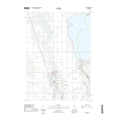
2018 Map of Necedah
USGS Topo · Published 2018About this map
Necedah serves as the focal point of this Juneau County landscape, situated at a bend where the Little Yellow River winds south toward its confluence. The terrain is defined by striking topographic contrasts, with the prominent elevation of Necedah Bluff rising abruptly just west of the village center, while to the east, the massive expanse of Petenwell Lake and the Wisconsin River corridor dominate the horizon. This 2018 survey reveals a complex hydrological network of managed waterways, including the West Petenwell Ditch, which cuts a straight line through the wetlands north of the village.
Find a feature on this map
70 named features on this map. Tap any name to fly to it.
Don’t see what you’re looking for? This feature index may not catch every label — zoom into the map to look around manually.
Map Details
Editions of this 2018 Necedah Map
This is the sole edition of this map. No revisions or reprints were ever made.
Other maps of this area

1921 · Mauston
USGS Topo · 1:62,500

1953 · Eau Claire
USGS Topo · 1:250,000

1955 · Green Bay
USGS Topo · 1:250,000

1957 · Madison
USGS Topo · 1:250,000

1958 · Eau Claire
USGS Topo · 1:250,000

1958 · Arkdale
USGS Topo · 1:48,000

1958 · Necedah
USGS Topo · 1:48,000

1958 · La Crosse
USGS Topo · 1:250,000

1960 · Madison
USGS Topo · 1:250,000

1961 · La Crosse
USGS Topo · 1:250,000