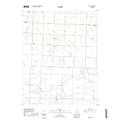
2017 Map of Neck City
USGS Topo · Published 2017About this map
Nashville and Neck City anchor this map of the western Missouri borderlands, where the landscape is defined by the winding course of the North Fork Spring River. Small rural hubs like Cossville, Preston, and Tuckers Corner are scattered across a grid of section lines and county roads, reflecting the region's agricultural heritage. For genealogists, the map is particularly useful for locating several family-named burial grounds, including Shapley Cem, Bradford Cem, and Cedar Bluff Cem, many of which are tucked away near local tributaries such as Duval Cr and Slater Br. The topography reveals a transition from open prairie toward the river drainage, featuring landmarks like Shelton Lake and Barker Lake. This survey provides a precise look at the 21st-century rural infrastructure along the Barton Co and Jasper Co line.
Find a feature on this map
73 named features on this map. Tap any name to fly to it.
Don’t see what you’re looking for? This feature index may not catch every label — zoom into the map to look around manually.
Map Details
Editions of this 2017 Neck City Map
This is the sole edition of this map. No revisions or reprints were ever made.
Other maps of this area

1886 · Joplin
USGS Topo · 1:125,000

1886 · Carthage
USGS Topo · 1:125,000

1894 · Joplin
USGS Topo · 1:125,000

1894 · Carthage
USGS Topo · 1:125,000

1945 · Pittsburg
USGS Topo · 1:62,500

1947 · Joplin
USGS Topo · 1:250,000

1947 · Pittsburg
USGS Topo · 1:62,500

1949 · Joplin
USGS Topo · 1:250,000

1950 · Pittsburg
USGS Topo · 1:62,500

1954 · Joplin
USGS Topo · 1:250,000