Loading...
Loading map...2021 Map of Neck City
USGS Topo · Published 2021About this map
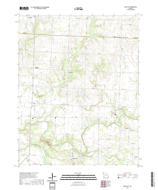
Neck City and the surrounding agricultural lands of the Barton Co Jasper Co border define this corner of Missouri. The landscape is characterized by a dense network of country roads following the section lines, connecting small hubs like Tuckers Corner and Cossville. Waterways such as the North Fork Spring River and Spring River meander through the southern half of the quadrangle, where they are joined by tributaries like Slater Br and Buck Branch.
Find a feature on this map
42 named features on this map. Tap any name to fly to it.
Don’t see what you’re looking for? This feature index may not catch every label — zoom into the map to look around manually.
Map Details
Date Portrayed2021
Date Published2021
PublisherU.S. Geological Survey
Map TypeTopographic
Scale1:24000
Physical Dimensions24 x 29 inches
Editions of this 2021 Neck City Map
This is the sole edition of this map. No revisions or reprints were ever made.
Historical Maps of Neck City Through Time

Featured Locations
Source Details
SourceU.S. Geological Survey
CopyrightPublic Domain