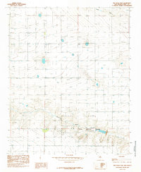
1985 Map of Ned Houk Park
USGS Topo · Published 1985About this map
Ned Houk Park (City of Clovis) dominates the southeastern portion of this High Plains landscape, situated northeast of the city itself. This 1985 survey captures a region defined by agricultural infrastructure and drainage patterns, specifically where the terrain begins to drop into the shallow valleys of Running Water Draw and Mustang Draw. The settlement of Claud serves as a central landmark amidst an extensive network of groundwater extraction points, with numerous labels for Well scattered across the surrounding sections. The map reveals the systematic development of the area's water resources and the integration of large-scale municipal recreation space within the rural grid of Curry County during the mid-1980s.
Find a feature on this map
5 named features on this map. Tap any name to fly to it.
Don’t see what you’re looking for? This feature index may not catch every label — zoom into the map to look around manually.
Map Details
Editions of this 1985 Ned Houk Park Map
This is the sole edition of this map. No revisions or reprints were ever made.
Other maps of this area

1954 · Clovis
USGS Topo · 1:250,000

1957 · Portair
USGS Topo · 1:62,500

1957 · Clovis
USGS Topo · 1:62,500

1957 · Pleasant Hill
USGS Topo · 1:62,500

1957 · Hammond Ranch
USGS Topo · 1:62,500

1958 · Clovis
USGS Topo · 1:250,000

1985 · Portair
USGS Topo · 1:24,000

1985 · Pleasant Hill NW
USGS Topo · 1:24,000

1985 · Smith Ranch
USGS Topo · 1:24,000

1985 · Pleasant Hill
USGS Topo · 1:24,000