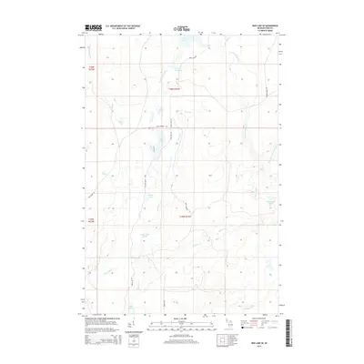
2014 Map of Ned Lake SE
USGS Topo · Published 2014About this map
Bone Lake and the winding course of the W Br Fence River anchor this landscape in Iron County, Michigan. The territory is characterized by an intricate network of waterways, including Twenty Six Creek, Deer River, and Johnson Cr, which suggests a drainage pattern vital to the local timber and hunting grounds of the Upper Peninsula. Numerous named bodies of water such as Sullivan Lake, Diana Pond, and the Camp Eight Ponds are dispersed throughout the townships of T46N R32W and T45N R32W. Human imprint is visible primarily through a system of secondary roads and trails like The Grade Rd and Wilson Grade Rd, names that reflect the region's logging history and the established routes used to navigate this watery terrain. These features, along with landmarks like Hardwood Lake and Square Lake, provide clear points of reference for those studying the rural development of the Northwoods.
Find a feature on this map
33 named features on this map. Tap any name to fly to it.
Don’t see what you’re looking for? This feature index may not catch every label — zoom into the map to look around manually.
Map Details
Editions of this 2014 Ned Lake SE Map
This is the sole edition of this map. No revisions or reprints were ever made.
Other maps of this area

1895 · Ned Lake
USGS Topo · 1:62,500

1899 · Sagola
USGS Topo · 1:62,500

1899 · Witbeck
USGS Topo · 1:62,500

1899 · Crystal Falls
USGS Topo · 1:62,500

1945 · Kelso Junction
USGS Topo · 1:24,000

1945 · Amasa
USGS Topo · 1:24,000

1947 · Kiernan
USGS Topo · 1:24,000
1947 · Amasa
USGS Topo · 1:24,000

1947 · Kelso Junction
USGS Topo · 1:24,000

1955 · Ned Lake
USGS Topo · 1:62,500