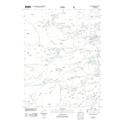
2011 Map of Nederland
USGS Topo · Published 2011About this map
Caribou City and the surrounding high-altitude mining districts define the character of this mountain landscape. The density of mining claims and infrastructure is remarkable, with operations like the Caribou Shaft, Seventhirty Tunnel, and the extensive Rocky Mountain Gold Mines concentrated around Caribou Hill. This industrial history is juxtaposed with the mid-century development of the Lake Eldora Ski Area and academic interests like the University of Colorado Observatory, marking the area's transition from extractive industry to recreation and research.
Find a feature on this map
195 named features on this map. Tap any name to fly to it.
Don’t see what you’re looking for? This feature index may not catch every label — zoom into the map to look around manually.
Map Details
Editions of this 2011 Nederland Map
This is the sole edition of this map. No revisions or reprints were ever made.
Other maps of this area

1899 · West Denver
USGS Topo · 1:125,000

1902 · Boulder
USGS Topo · 1:62,500

1904 · Boulder
USGS Topo · 1:62,500

1905 · Central City
USGS Topo · 1:62,500

1906 · Blackhawk
USGS Topo · 1:62,500

1910 · Central City
USGS Topo · 1:62,500

1912 · Central City
USGS Topo · 1:62,500

1915 · Longs Peak
USGS Topo · 1:125,000

1919 · Rocky Mountain National Park
USGS Topo · 1:125,000

1942 · Nederland
USGS Topo · 1:24,000