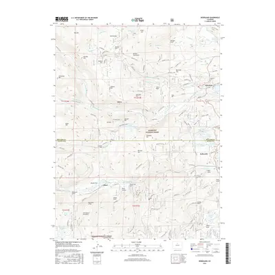
2016 Map of Nederland
USGS Topo · Published 2016About this map
Nederland and the high mountain settlements of the Front Range appear here in 2016, defined by a landscape of deep gulches and historic mining districts. The map documents the complex relationship between water management and human habitation, showing major infrastructure like Barker Reservoir and the Lakewood Reservoir alongside the legacy of early extraction at the Anchor Mine near Caribou. The terrain is marked by significant peaks, including Bald Mtn and Eldorado Mtn, which frame the valley floors where Eldora and Tolland are situated. Notable transportation corridors such as the historic Moffat Road and the Rollins W spur reflect the region's engineering history. Cultural sites including the Nederland Cem provide essential data for genealogists, while the boundaries of the Roosevelt National Forest and Arapaho National Forest indicate the preservation of the surrounding wilderness.
Find a feature on this map
124 named features on this map. Tap any name to fly to it.
Don’t see what you’re looking for? This feature index may not catch every label — zoom into the map to look around manually.
Map Details
Editions of this 2016 Nederland Map
This is the sole edition of this map. No revisions or reprints were ever made.
Other maps of this area

1899 · West Denver
USGS Topo · 1:125,000

1902 · Boulder
USGS Topo · 1:62,500

1904 · Boulder
USGS Topo · 1:62,500

1905 · Central City
USGS Topo · 1:62,500

1906 · Blackhawk
USGS Topo · 1:62,500

1910 · Central City
USGS Topo · 1:62,500

1912 · Central City
USGS Topo · 1:62,500

1915 · Longs Peak
USGS Topo · 1:125,000

1919 · Rocky Mountain National Park
USGS Topo · 1:125,000

1942 · Nederland
USGS Topo · 1:24,000