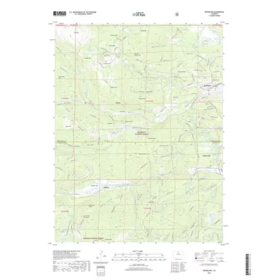
2019 Map of Nederland
USGS Topo · Published 2019About this map
Nederland serves as the focal point of this Front Range landscape, situated near the Lakewood Reservoir and the headwaters of Middle Boulder Cr. The settlement pattern follows the steep topography of the Roosevelt National Forest, where historical mining sites like the Anchor Mine on Caribou Hill and the Enterprise Mine near Spencer Mtn reflect the region's mineral heritage. Further south, the communities of Eldora, Rollinsville, and Tolland are linked by the winding paths of S Boulder Cr and the local road network, including the Moffat Road and Boulder Canyon Dr.
Find a feature on this map
119 named features on this map. Tap any name to fly to it.
Don’t see what you’re looking for? This feature index may not catch every label — zoom into the map to look around manually.
Map Details
Editions of this 2019 Nederland Map
This is the sole edition of this map. No revisions or reprints were ever made.
Other maps of this area

1899 · West Denver
USGS Topo · 1:125,000

1902 · Boulder
USGS Topo · 1:62,500

1904 · Boulder
USGS Topo · 1:62,500

1905 · Central City
USGS Topo · 1:62,500

1906 · Blackhawk
USGS Topo · 1:62,500

1910 · Central City
USGS Topo · 1:62,500

1912 · Central City
USGS Topo · 1:62,500

1915 · Longs Peak
USGS Topo · 1:125,000

1919 · Rocky Mountain National Park
USGS Topo · 1:125,000

1942 · Nederland
USGS Topo · 1:24,000