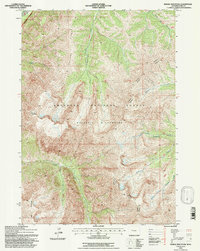
1991 Map of Needle Mountain
USGS Topo · Published 1997About this map
Washakie Wilderness and the Shoshone National Forest dominate this high-elevation landscape within the Wyoming mountains. This 1991 revision, based on 1969 aerial photography, highlights a topography defined by steep ridges and dramatic drainage basins, specifically where the Wapiti Ranger District meets the Greybull Ranger District. The terrain is anchored by massive landmarks such as Needle Mountain and Crater Mountain, with significant watercourses like Needle Creek and Boulder Basin Creek carving through the granite and forest.
Find a feature on this map
15 named features on this map. Tap any name to fly to it.
Don’t see what you’re looking for? This feature index may not catch every label — zoom into the map to look around manually.
Map Details
Editions of this 1991 Needle Mountain Map
This is the sole edition of this map. No revisions or reprints were ever made.
Other maps of this area

1893 · Ishawooa
USGS Topo · 1:125,000

1895 · Ishawooa
USGS Topo · 1:125,000

1899 · Ishawooa
USGS Topo · 1:125,000

1904 · Kirwin
USGS Topo · 1:125,000

1905 · Younts Peak
USGS Topo · 1:125,000

1906 · Kirwin
USGS Topo · 1:125,000

1907 · Younts Peak
USGS Topo · 1:125,000

1955 · Cody
USGS Topo · 1:250,000

1955 · Thermopolis
USGS Topo · 1:250,000

1956 · Emerald Lake
USGS Topo · 1:24,000