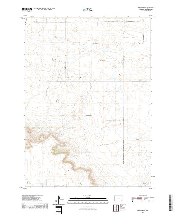
2021 Map of Needle Rock
USGS Topo · Published 2021About this map
Needle Rock stands as a prominent landmark in this corner of Goshen County, surrounded by a series of distinct geological formations including Sugar Bowl Rock and Steamboat Rock. The landscape is defined by its drainage patterns, with Needle Draw and Josh Canyon cutting through the terrain towards lower elevations. Water sources are primarily seasonal or intermittent creeks such as Corn Cr, Josh Cr, and Lone Tree Cr. This high-plains geography is largely organized by the Public Land Survey System, with the map clearly delineating the township boundaries between t22n r64w and t21n r63w. The presence of Jackson Canyon in the southern portion further illustrates the erosion-carved nature of this cattle country, where established rural routes like RD 27 and Co RD 32 provide the primary access through the open range.
Find a feature on this map
21 named features on this map. Tap any name to fly to it.
Don’t see what you’re looking for? This feature index may not catch every label — zoom into the map to look around manually.
Map Details
Editions of this 2021 Needle Rock Map
This is the sole edition of this map. No revisions or reprints were ever made.
Other maps of this area

1899 · Goshen Hole
USGS Topo · 1:125,000

1954 · Cheyenne
USGS Topo · 1:250,000

1958 · Cheyenne
USGS Topo · 1:250,000

1960 · Veteran
USGS Topo · 1:24,000

1960 · Diamond Flat
USGS Topo · 1:24,000

1960 · Hawk Springs
USGS Topo · 1:24,000

1960 · Needle Rock
USGS Topo · 1:24,000

1960 · Kessler Gap
USGS Topo · 1:24,000
1960 · Yoder
USGS Topo · 1:24,000

1963 · Y B O Canyon
USGS Topo · 1:24,000