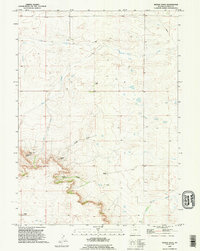
1990 Map of Needle Rock
USGS Topo · Published 1995About this map
Needle Rock and the sharp escarpments of Jackson Canyon dominate this portion of Goshen County, where the high plains break into a series of dramatic outcrops. The landscape reflects a legacy of cattle ranching, with established family holdings like the Otto Ranch, Hunter Ranch, and Wilkins Ranch scattered across the drainages. These operations relied on a network of intermittent water sources including Corn Creek, Josh Creek, and the southern Lone Tree Creek.
Find a feature on this map
16 named features on this map. Tap any name to fly to it.
Don’t see what you’re looking for? This feature index may not catch every label — zoom into the map to look around manually.
Map Details
Editions of this 1990 Needle Rock Map
This is the sole edition of this map. No revisions or reprints were ever made.
Other maps of this area

1899 · Goshen Hole
USGS Topo · 1:125,000

1954 · Cheyenne
USGS Topo · 1:250,000

1958 · Cheyenne
USGS Topo · 1:250,000

1960 · Veteran
USGS Topo · 1:24,000

1960 · Diamond Flat
USGS Topo · 1:24,000

1960 · Hawk Springs
USGS Topo · 1:24,000

1960 · Needle Rock
USGS Topo · 1:24,000

1960 · Kessler Gap
USGS Topo · 1:24,000
1960 · Yoder
USGS Topo · 1:24,000

1963 · Y B O Canyon
USGS Topo · 1:24,000