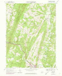
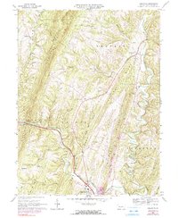
1967 Map of Needmore
USGS Topo · Published 1973About this map
Sideling Hill and Brush Ridge dominate this section of the Ridge-and-Valley Appalachians in southern Fulton County, defining a landscape of parallel ridges and narrow agricultural corridors. The settlement of Needmore serves as a local hub along the Barnetts Run drainage, while Warfordsburg sits to the south near the Maryland border, connected by the burgeoning interstate infrastructure of the late 1960s. Rural life is anchored by numerous country houses of worship, including Pleasant Grove Ch, Hill Chapel, and Bethel Ch, which are scattered among the timbered slopes of State Game Lands No 65 and State Game Lands No 128. The winding course of Tonoloway Creek and its tributaries, such as Little Tonoloway Creek, provide the primary drainage for the area's small-scale farming and limestone quarrying operations. Significant topographic features like Deneen Gap illustrate how early transportation routes were forced to navigate the formidable north-south mountain barriers.
Find a feature on this map
37 named features on this map. Tap any name to fly to it.
Don’t see what you’re looking for? This feature index may not catch every label — zoom into the map to look around manually.
Map Details
Editions of this 1967 Needmore Map
5 editions found
Other maps of this area

1898 · Paw Paw
USGS Topo · 1:62,500

1899 · Hancock
USGS Topo · 1:62,500

1900 · Pawpaw
USGS Topo · 1:62,500

1901 · Hancock
USGS Topo · 1:62,500

1910 · Paw Paw
USGS Topo · 1:62,500

1925 · Needmore
USGS Topo · 1:48,000

1927 · Clearville
USGS Topo · 1:48,000

1931 · Clearville
USGS Topo · 1:62,500

1935 · Needmore
USGS Topo · 1:62,500

1939 · Needmore
USGS Topo · 1:62,500
Featured Places
- Bethel Township, PA
- Union Township, PA
- Brush Creek Township, PA
- Belfast Township, PA
- Thompson Township, PA