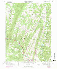
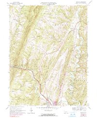
1967 Map of Needmore
USGS Topo · Published 1977About this map
Sideling Hill and a series of prominent ridges dominate this section of Fulton County, shaping the settlement patterns of several small rural communities in the late 1960s. The landscape is defined by long, parallel elevations including Belfast Ridge and Bethel Ridge, which funnel local life into the narrow valleys of Tonoloway Creek and its many branches. The distribution of family-centered landmarks such as Bedford Chapel and Mays Chapel reflects a classic Appalachian valley-and-ridge social structure, where community life clustered around small crossroads like Needmore and Warfordsburg.
Find a feature on this map
35 named features on this map. Tap any name to fly to it.
Don’t see what you’re looking for? This feature index may not catch every label — zoom into the map to look around manually.
Map Details
Editions of this 1967 Needmore Map
5 editions found
Other maps of this area

1898 · Paw Paw
USGS Topo · 1:62,500

1899 · Hancock
USGS Topo · 1:62,500

1900 · Pawpaw
USGS Topo · 1:62,500

1901 · Hancock
USGS Topo · 1:62,500

1910 · Paw Paw
USGS Topo · 1:62,500

1925 · Needmore
USGS Topo · 1:48,000

1927 · Clearville
USGS Topo · 1:48,000

1931 · Clearville
USGS Topo · 1:62,500

1935 · Needmore
USGS Topo · 1:62,500

1939 · Needmore
USGS Topo · 1:62,500
Featured Places
- Bethel Township, PA
- Union Township, PA
- Brush Creek Township, PA
- Belfast Township, PA
- Thompson Township, PA