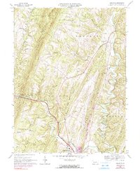
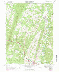
1967 Map of Needmore
USGS Topo · Published 1990About this map
Sideling Hill and a series of parallel ridges define the landscape of south-central Pennsylvania during the late 1960s. This survey records a network of rural settlements and remote mountain gaps, where winding waterways like Tonoloway Creek and Brush Creek carve through the steep terrain. The map captures the transit-oriented nature of the region, anchored by the community of Warfordsburg at the southern edge and the hamlet of Needmore situated along Barnetts Run.
Find a feature on this map
38 named features on this map. Tap any name to fly to it.
Don’t see what you’re looking for? This feature index may not catch every label — zoom into the map to look around manually.
Map Details
Editions of this 1967 Needmore Map
5 editions found
Other maps of this area

1898 · Paw Paw
USGS Topo · 1:62,500

1899 · Hancock
USGS Topo · 1:62,500

1900 · Pawpaw
USGS Topo · 1:62,500

1901 · Hancock
USGS Topo · 1:62,500

1910 · Paw Paw
USGS Topo · 1:62,500

1925 · Needmore
USGS Topo · 1:48,000

1927 · Clearville
USGS Topo · 1:48,000

1931 · Clearville
USGS Topo · 1:62,500

1935 · Needmore
USGS Topo · 1:62,500

1939 · Needmore
USGS Topo · 1:62,500
Featured Places
- Bethel Township, PA
- Union Township, PA
- Brush Creek Township, PA
- Belfast Township, PA
- Thompson Township, PA