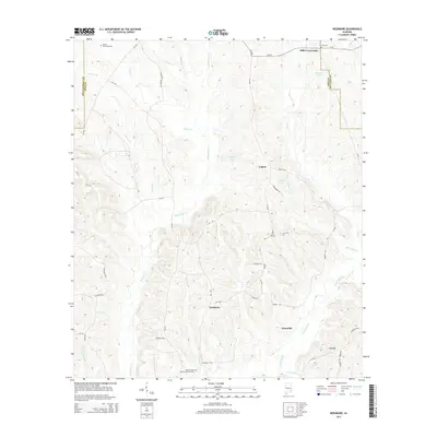
2014 Map of Needmore
USGS Topo · Published 2014About this map
Needmore and the surrounding reaches of the Conecuh River valley define this portion of Pike County as it appeared in the early 21st century. The landscape is characterized by a network of rural county roads that connect several small settlements and family-named landmarks. To the north, Stills Crossroads serves as a junction near Stills Cem, while Logton is situated among several water bodies including Copelands Pond and Costons Pond. This survey provides valuable documentation for genealogists, as it identifies numerous family burial sites such as the McNeil Townsend Cem and the Williams and Andrew Jackson Cem near the southern boundary. The drainage pattern is intricate, with numerous tributaries like Jackson Cr, Indian Cr, and the descriptively named Nappy Head Br feeding into the main river system, illustrating the hydrology that has shaped local land use for generations.
Find a feature on this map
52 named features on this map. Tap any name to fly to it.
Don’t see what you’re looking for? This feature index may not catch every label — zoom into the map to look around manually.
Map Details
Editions of this 2014 Needmore Map
This is the sole edition of this map. No revisions or reprints were ever made.
Other maps of this area

1953 · Montgomery
USGS Topo · 1:250,000

1953 · Andalusia
USGS Topo · 1:250,000

1953 · Dothan
USGS Topo · 1:250,000

1954 · Dothan
USGS Topo · 1:250,000

1955 · Dothan
USGS Topo · 1:250,000

1955 · Phenix City
USGS Topo · 1:250,000

1956 · Montgomery
USGS Topo · 1:250,000

1957 · Phenix City
USGS Topo · 1:250,000

1957 · Montgomery
USGS Topo · 1:250,000

1957 · Andalusia
USGS Topo · 1:250,000