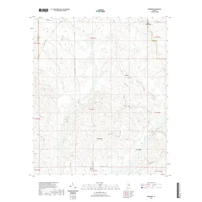
2020 Map of Needmore
USGS Topo · Published 2020About this map
The Conecuh River meanders through the southeast corner of this landscape, a region defined by its dispersed rural settlements and network of family-named landmarks. Small communities like Needmore and Jonesville anchor the southern reaches, while the northern terrain is marked by Stills Crossroads at the junction of Bullock Co 8 and Co Rd 69. The map reveals a deeply personal history of the land through its numerous small burial grounds, including the McNeil - Townsend Cem and the Williams and Andrew Jackson Cem. The hydrography of the area is complex, with numerous tributaries such as Munnings Cr and Jackson Cr feeding into larger systems, and isolated water bodies like Copelands Pond and Costons Pond punctuating the wooded tracts. This 2020 edition captures the enduring rural character of the Alabama countryside, where legacy roads and family landholdings remain the primary features of the local geography.
Find a feature on this map
71 named features on this map. Tap any name to fly to it.
Don’t see what you’re looking for? This feature index may not catch every label — zoom into the map to look around manually.
Map Details
Editions of this 2020 Needmore Map
This is the sole edition of this map. No revisions or reprints were ever made.
Other maps of this area

1953 · Montgomery
USGS Topo · 1:250,000

1953 · Andalusia
USGS Topo · 1:250,000

1953 · Dothan
USGS Topo · 1:250,000

1954 · Dothan
USGS Topo · 1:250,000

1955 · Dothan
USGS Topo · 1:250,000

1955 · Phenix City
USGS Topo · 1:250,000

1956 · Montgomery
USGS Topo · 1:250,000

1957 · Phenix City
USGS Topo · 1:250,000

1957 · Montgomery
USGS Topo · 1:250,000

1957 · Andalusia
USGS Topo · 1:250,000