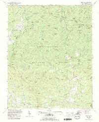
1988 Map of Neels Gap
USGS Topo · Published 1991About this map
Lake Winfield Scott and the surrounding wilderness of the Chattahoochee National Forest dominate this late-twentieth-century survey of the Blue Ridge mountains. The map documents the high-elevation terrain where the Union and Lumpkin county lines meet, following the winding path of the Appalachian Trail across several significant peaks and gaps. Small rural communities and intersections like Turners Corner and Fort Smith anchor the lower elevations, where the Chestatee River and Yahoola Creek begin their descent.
Find a feature on this map
130 named features on this map. Tap any name to fly to it.
Don’t see what you’re looking for? This feature index may not catch every label — zoom into the map to look around manually.
Map Details
Editions of this 1988 Neels Gap Map
3 editions found
Other maps of this area

1886 · Dahlonega
USGS Topo · 1:125,000

1888 · Ellijay
USGS Topo · 1:125,000

1892 · Dahlonega
USGS Topo · 1:125,000

1892 · Ellijay
USGS Topo · 1:125,000

1896 · Dahlonega
USGS Topo · 1:125,000

1898 · Ellijay
USGS Topo · 1:125,000

1903 · Dahlonega
USGS Topo · 1:125,000

1911 · Ellijay
USGS Topo · 1:125,000

1935 · Coosa Bald
USGS Topo · 1:24,000

1935 · Mulky Gap
USGS Topo · 1:24,000