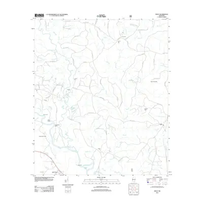
2012 Map of Neely
USGS Topo · Published 2012About this map
Leaf River dominates the southwestern portion of this landscape, its winding course punctuated by features like Gin House Bluff, Red Bluff, and Breland Eddy. The surrounding terrain transitions into the upland Hillman Hills and Gee Dee Hills, separated by a dense network of tributaries including Gaines Cr and Atkinson Cr. The settlement of Neely sits in the east, while the smaller community of Little Creek lies along the southern edge, connected by a series of family-named rural routes such as Hogpen Rd and Arch Turner Rd. Local genealogy and land use patterns are anchored by several burial grounds, including Sylvester Cem, Buffalo Cem, and Pleasant Hill Cem. The map reveals a working southern landscape defined by timber-era landmarks like Dantzler Pond and Pauls Stumps, alongside geographical points like Mossy Hammock and Steep Hollow.
Find a feature on this map
63 named features on this map. Tap any name to fly to it.
Don’t see what you’re looking for? This feature index may not catch every label — zoom into the map to look around manually.
Map Details
Editions of this 2012 Neely Map
This is the sole edition of this map. No revisions or reprints were ever made.
Other maps of this area

1947 · Beaumont
USGS Topo · 1:62,500

1949 · Beaumont
USGS Topo · 1:62,500

1953 · Hattiesburg
USGS Topo · 1:250,000

1958 · Hattiesburg
USGS Topo · 1:250,000

1963 · Brewer
USGS Topo · 1:24,000

1964 · Richton
USGS Topo · 1:24,000

1964 · Avera
USGS Topo · 1:24,000

1973 · Jonathan
USGS Topo · 1:24,000
1973 · Leakesville SW
USGS Topo · 1:24,000
1982 · Neely
USGS Topo · 1:24,000