
1973 Map of Jonathan
USGS Topo · Published 1974About this map
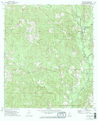
Big Creek and its many tributaries, including Mason Branch and Long Branch, define the rural landscape of Greene County in the early 1970s. This survey of the Jonathan quadrangle illustrates a scattered settlement pattern typical of the piney woods region, with small communities such as Kittrell, Byrd, and Bradley serving as local hubs. The presence of the Green Lookout Tower on a prominent ridge reflects the importance of timber management and fire watch in this densely wooded area. Genealogists and local historians can locate several landmark institutions, including Corinth Ch and the Church of Jesus Christ, alongside the Hillman Cem. The terrain is also marked by industrial activity and infrastructure, such as various Sandpit sites and a major pipeline corridor that cuts through the southern reaches of the map near Big Oktibee Cr.
Find a feature on this map
25 named features on this map. Tap any name to fly to it.
Don’t see what you’re looking for? This feature index may not catch every label — zoom into the map to look around manually.
Map Details
Editions of this 1973 Jonathan Map
2 editions found
Other maps of this area

1947 · Beaumont
USGS Topo · 1:62,500

1949 · Beaumont
USGS Topo · 1:62,500

1953 · Hattiesburg
USGS Topo · 1:250,000

1958 · Hattiesburg
USGS Topo · 1:250,000

1963 · Brewer
USGS Topo · 1:24,000

1964 · Clark
USGS Topo · 1:24,000

1964 · Avera
USGS Topo · 1:24,000

1972 · Leakesville
USGS Topo · 1:24,000
1972 · Vernal
USGS Topo · 1:24,000
1973 · Leakesville SW
USGS Topo · 1:24,000