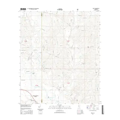
2015 Map of Neely
USGS Topo · Published 2015About this map
The Leaf River winds through the heart of this Perry and Greene County landscape, defining a region where river bottomlands meet the rising elevations of the Hillman Hills and Skull Creek Hills. Within the protected boundaries of the Desoto National Forest, the terrain is marked by distinctive features such as Gin House Bluff and Red Bluff, while local water bodies like Dantzler Pond and Breland Eddy highlight the area's hydraulic character.
Find a feature on this map
87 named features on this map. Tap any name to fly to it.
Don’t see what you’re looking for? This feature index may not catch every label — zoom into the map to look around manually.
Map Details
Editions of this 2015 Neely Map
This is the sole edition of this map. No revisions or reprints were ever made.
Other maps of this area

1947 · Beaumont
USGS Topo · 1:62,500

1949 · Beaumont
USGS Topo · 1:62,500

1953 · Hattiesburg
USGS Topo · 1:250,000

1958 · Hattiesburg
USGS Topo · 1:250,000

1963 · Brewer
USGS Topo · 1:24,000

1964 · Richton
USGS Topo · 1:24,000

1964 · Avera
USGS Topo · 1:24,000

1973 · Jonathan
USGS Topo · 1:24,000
1973 · Leakesville SW
USGS Topo · 1:24,000
1982 · Neely
USGS Topo · 1:24,000