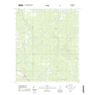
2021 Map of Neely
USGS Topo · Published 2021About this map
De Soto National Forest dominates the southern landscape of this territory, where the Leaf River carves a winding path past notable riverbank features like Gin House Bluff and Red Bluff. The terrain is defined by distinct topographical rises, including the Skull Creek Hills, Hillman Hills, and the Gee Dee Hills to the south. Small settlements and localized landmarks are scattered throughout, with Neely situated in the east and Little Creek to the southwest near the county line between Perry and Greene counties.
Find a feature on this map
84 named features on this map. Tap any name to fly to it.
Don’t see what you’re looking for? This feature index may not catch every label — zoom into the map to look around manually.
Map Details
Editions of this 2021 Neely Map
This is the sole edition of this map. No revisions or reprints were ever made.
Other maps of this area

1947 · Beaumont
USGS Topo · 1:62,500

1949 · Beaumont
USGS Topo · 1:62,500

1953 · Hattiesburg
USGS Topo · 1:250,000

1958 · Hattiesburg
USGS Topo · 1:250,000

1963 · Brewer
USGS Topo · 1:24,000

1964 · Richton
USGS Topo · 1:24,000

1964 · Avera
USGS Topo · 1:24,000

1973 · Jonathan
USGS Topo · 1:24,000
1973 · Leakesville SW
USGS Topo · 1:24,000
1982 · Neely
USGS Topo · 1:24,000