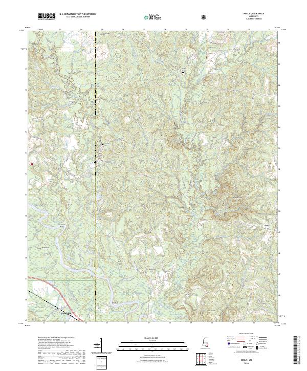
2024 Map of Neely
USGS Topo · Published 2024About this map
The Leaf River meanders across this corner of Southeast Mississippi, carving out distinctive landmarks like Gin House Bluff and Red-Bluff. The landscape is a transition between the managed timberlands of the De Soto National Forest and the agricultural reaches surrounding the settlement of Neely. The terrain is defined by a series of low ridges and hollows, including the Hillman Hills and Skull Creek Hills, where numerous small cemeteries such as Pleasant Hill Cem and Sylvester Cem sit atop high ground. Historically significant water features like Dantzler Pond and McSwain Branch illustrate the local drainage patterns that shaped early homesteading and transport routes in both Perry and Greene counties. A dense network of local roads, including Old Hwy 24 and Randall Byrd Rd, provides access to the dispersed rural community of Little Creek and the surrounding forest tracts.
Find a feature on this map
83 named features on this map. Tap any name to fly to it.
Don’t see what you’re looking for? This feature index may not catch every label — zoom into the map to look around manually.
Map Details
Editions of this 2024 Neely Map
This is the sole edition of this map. No revisions or reprints were ever made.
Other maps of this area

1947 · Beaumont
USGS Topo · 1:62,500

1949 · Beaumont
USGS Topo · 1:62,500

1953 · Hattiesburg
USGS Topo · 1:250,000

1958 · Hattiesburg
USGS Topo · 1:250,000

1963 · Brewer
USGS Topo · 1:24,000

1964 · Richton
USGS Topo · 1:24,000

1964 · Avera
USGS Topo · 1:24,000

1973 · Jonathan
USGS Topo · 1:24,000
1973 · Leakesville SW
USGS Topo · 1:24,000
1982 · Neely
USGS Topo · 1:24,000